Understanding the measurement planes when setting up the measurement network
Each target viewed by a TotaLite sensor is assigned with a default plane. The goal of those planes is to enable a more intuitive data interpretation for the user.
Default plane
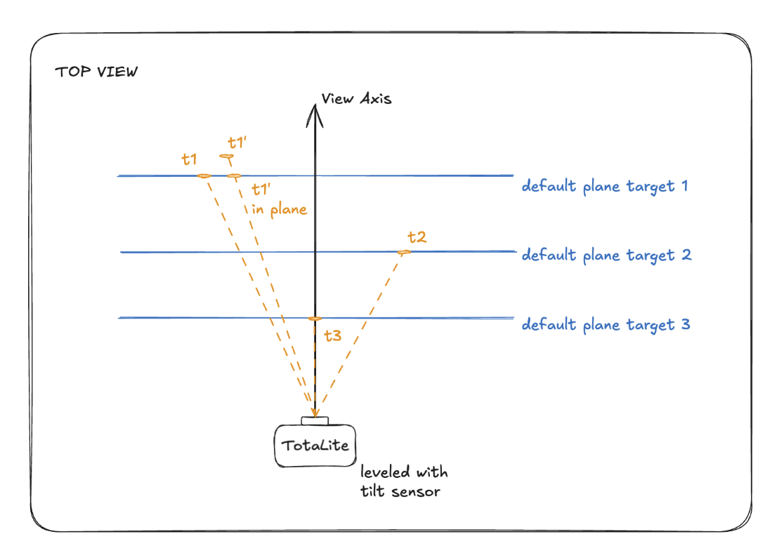
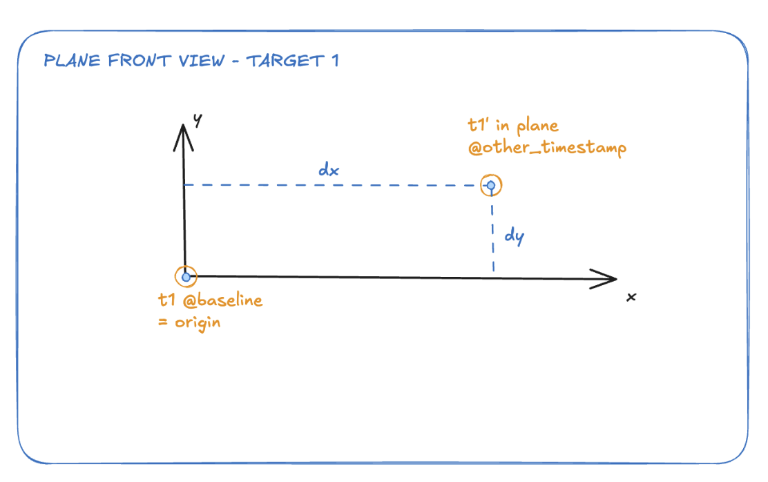
Created by default for each target viewed by TotaLite, this plane is made using the target location at baseline time as its origin and the TotaLite levelled view axis (i.e. in the plane perpendicular to the gravity vector) as its normal.
In such a default plane, a target’s movement can be decomposed into:
- Its vertical component, aligned with the gravity vector and positive when the target moves up
- Its horizontal component, perpendicular to the gravity vector and the TotaLite view axis, positive when the target moves to the right
- In the sketch below, the targets marked with an apostrophe represent their position at a new timestamp recorded later than the baseline.
NOTE: The TotaLite Sensor will not capture any displacement for movements away from or toward the device. TotaLite Sensor assumes the distance between the target and the sensor lens is constant across the deployment period.